...and structure
In their own words
An earthquake shock was felt at 9.15 PM on the 27th. I was sitting in the Shack writing up records at the time, and it seemed as if somebody had struck the south-west end of the place a severe blow with a bag of sand. Immediately afterwards a crashing sound, apparently some distance away on the eastern side, indicated that some rocks on the cliff-front had been dislodged.
— George Ainsworth in The Home of the Blizzard
Wind north-west, almost a dead calm. Packed camera and set off for Sandy Bay. On turning the last point I noticed to my surprise that the tussock-grass had been burnt and on getting closer — that the hut was burnt to the ground The wood was still smouldering in one place and the ground and stones were quite warm. Should think that the fire had occurred within the last 24 hours. Property lost consisted of sextant, blankets, sleeping bag, tent fly, books, boat’s compass, underclothes, socks and a host of other things. The worst loss to my mind is my specimens, all that I've collected this season. However, I will pack them away, but they will be useless for museum specimens. Hamilton lost a lot of gear. This has put a damper on my field work, as have no blankets. Returned to North End by 1.30pm.
— Diary entry by Leslie Blake
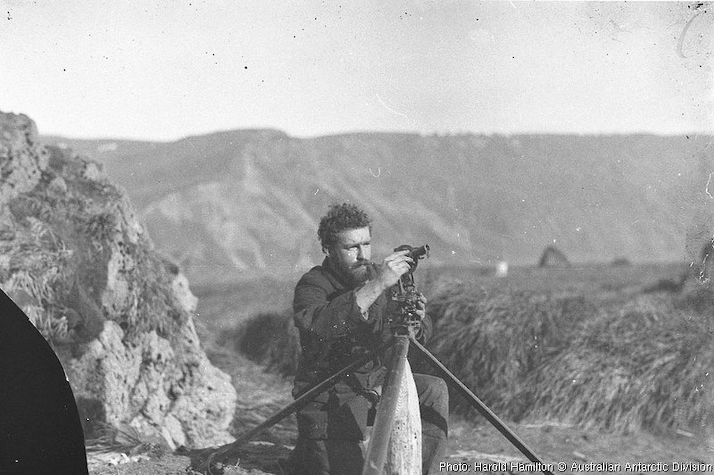
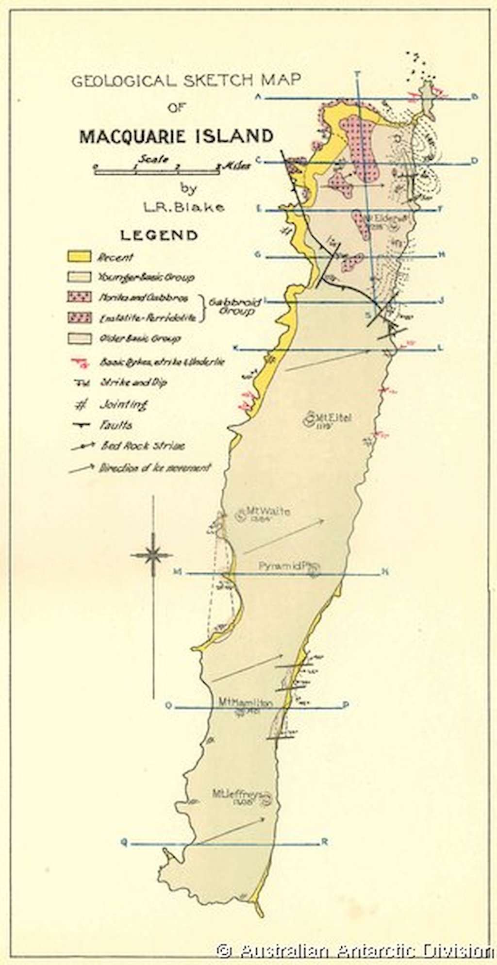
While surveying topography, Blake also collected rock specimens and made the first attempt to map the island’s geology. His map and notes are an enormous step forward from the sparse prior knowledge — mainly the result of a few hours ashore by Hartley Ferrar, a geologist in Scott’s 1901–1904 Antarctic Expedition.
But Blake’s geological map is incomplete. He had previously worked mainly with fossils, but could find barely a trace of these on the island, so he had to contend with areas of geology of which he knew virtually nothing. The work was not helped by a fire in 1913 that destroyed the Sandy Bay hut containing all his specimens from the central third of the island.
Blake thought he observed signs of glaciation on the island’s western shores. The weight of ice, he deduced, was a major reason for the apparent subsidence of that part of the island.
Much closer to the mark were his records of geological faults, including one on a large scale, and observations of coastal remains high above sea level, suggesting strong uplift. He and the others on the island were well aware of frequent earthquakes — 10 were noted during their two years there — but he had no instruments to record their strength, and missed the connection with the island’s faulting. His record laid the groundwork, but it was left to others, much later, to establish the links that filled out the story of Macquarie Island’s truly unique geological past.
Earth’s magnetic field was a major field of study for AAE, but Macquarie observations were limited to recording magnetic declination for navigation purposes during Aurora’s first visit in 1911. The observations at Caroline Cove and the Isthmus were conducted by Eric Webb, assisted by Alexander Kennedy and Belgrave Ninnis.