New lands
In their own words
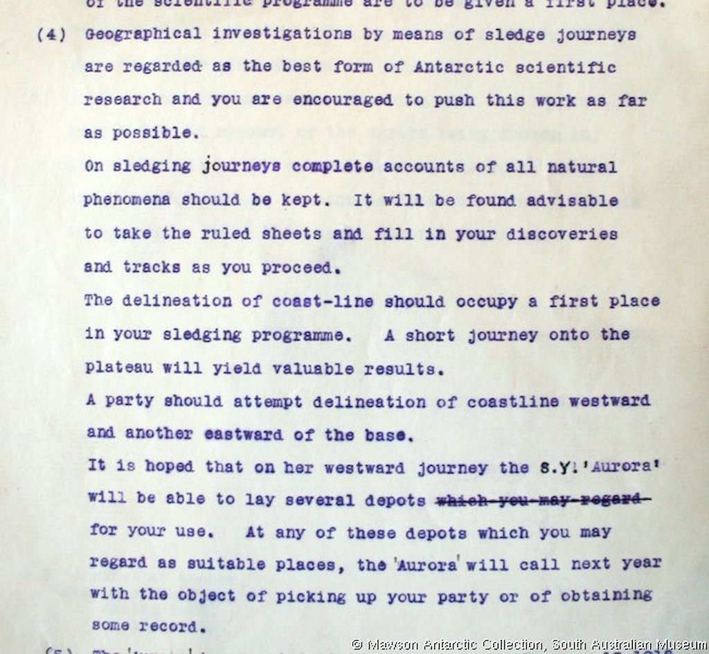
Geographical investigations by means of sledge journeys are regarded as the best form of Antarctic scientific research and you are encouraged to push this work as far as possible. On sledging journeys complete accounts of all natural phenomena should be kept. It will be found advisable to take the ruled sheets and fill in your discoveries and tracks as you proceed. The delineation of coast-line should occupy a first place in your sledging program. A short journey onto the plateau will lead to valuable results. A party should attempt delineation of coastline westward and another eastward of the base.
— Mawson’s leader’s brief to Frank Wild, written at Commonwealth Bay on 18 January, 1912
Our joint efforts had been successful in charting and otherwise investigating a length of about 400 miles [about 650kilometres] of coast in this very interesting region.
— Frank Wild’s report in The Home of the Blizzard
Map of coastline, glaciers, ice shelves and sea ice [PDF], as mapped by the AAE’s Western Party, and the sledging journeys undertaken from ‘The Grottoes’ in 1912–13. Map by peter Boyer, South Wind © Australian Antarctic Division.